


Trainsity Osaka
Description de Trainsity Osaka
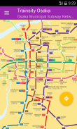
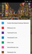
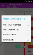
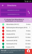
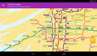
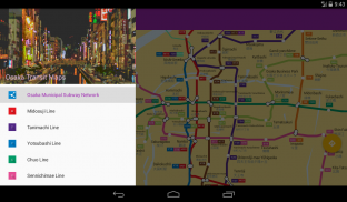
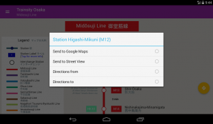
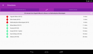
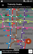
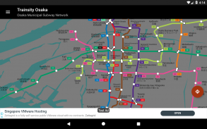
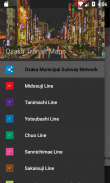
Trouvez votre chemin dans le métro d'Osaka en utilisant les cartes vectorielles haute résolution du réseau ferroviaire. Les lignes de métro suivantes sont disponibles: Midosuji, Tanimachi, Yotsubashi, Chuo, Sennichimae, Sakaisuji, Nagahori-Tsurumi-ryokuchi, Imazatosuji, Hiker Lignes de Kitakyu Namboku. Les cartes ont des empreintes de fichier de petite taille mais avec de nombreux niveaux de zoom et peuvent fonctionner hors connexion sans connexion à Internet. Les utilisateurs peuvent cliquer sur les étiquettes des boîtes de train pour ouvrir Google Maps ou Google StreetView, où ils peuvent utiliser toutes les fonctions des applications Google pour visualiser la région environnante et / ou effectuer un routage. Il existe également une fonction hors ligne permettant de calculer le meilleur moyen de transport d'une station à une autre avec une répartition de la direction et des horaires (pouvant varier du temps de déplacement réel).
* Maintenant, avec réglage du mode sombre.
Trainsity Osaka - Information APK
Version APK: 2.6.203Package: com.dom925.trainsity.osakaAncienne Version de Trainsity Osaka


Applications de même catégorie

Vous pourriez également aimer...


